John Muir Trail, 1971, 4th week, Onion Valley to Whitney Portal
4th Week: Onion Valley to Whitney Portal
Day 22: After the drunken blowout at the Onion Valley cafe, the next morning we went in the cars of Ken Primmer, my folks and Kevin’s family to Big Pine for breakfast, and to restock on extra food and to replace worn out equipment. I had a fantastic greasy breakfast, and it totally filled me.
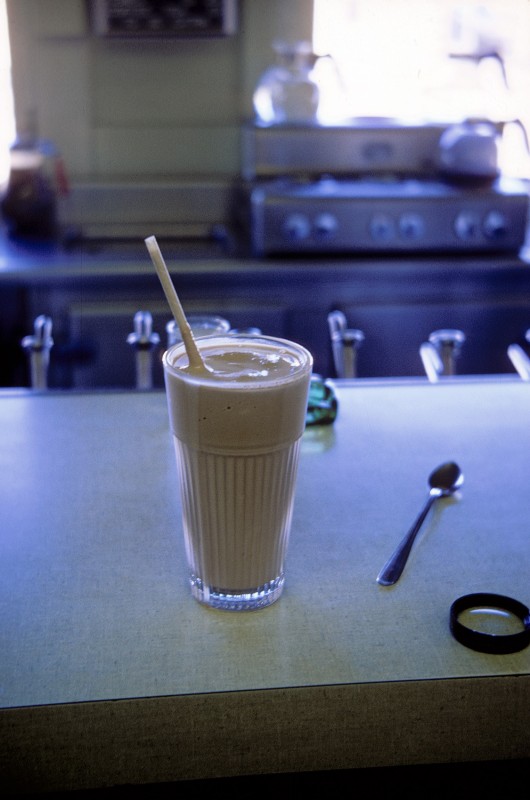
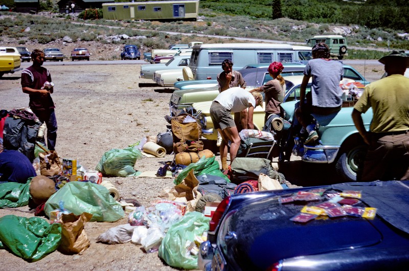
We milled around town buying socks and shirts, and lots of breads, cakes, pudding, powdered milk, and candy, to supplement our prepacked menu. We then returned to Onion Valley by noon, bought more food at the store, and proceeded about the large job of unpacking our food bundles and dividing them up into cook groups. It seemed that all the pressure was off me now that Ken and Mike were with us. Chuck had told us the previous night that he would not be going on for the last week, but would go get his car and go home.
Sometime in the afternoon we were finally ready, and ambled the two or three miles to Flower lake. There we discussed plans for the week, the fisher folk fished, and we just lazed in the sun. At supper we prepared spaghetti, but Steve Jepson dropped our pot full of spaghetti, leaving our dinner on the ground. We dined on bread pudding and drinks. Steve felt very bad, we felt very hungry.
Spaghetti anyone?

Day 23: The plan was to get over Kearsarge Pass and up Bubbs Creek as far as the highest wooded campsite. We would be headed for Forester Pass, which we would cross on Day 24. Ken, Kevin, Mike and I left early and hiked fast to the Bubbs Creek area. Ken and Mike had much trouble keeping up with Kevin and I, because we were in awesome shape and accustomed to the heavy packs. At Bubbs Creek we dropped packs and climbed University Peak, a big scree pile. The run down was fast and furious, with lots of rocks in your socks. Back at the packs we found an unintelligible note from Conrad, something about right turns and river crossings. We found them at a camp half a mile upstream from us, and we set about preparing a filling supper with dessert. We hoped to get an early start on Forester Pass, so we all went to bed early.

Above: Ken Primmer and me, Bob Shaver
Day 24:
“If we’re going to get an early start, we’d better get up,” said Madelyn to me.
“What time is it? Its still dark!” I said sleepily.
“5:00” said Madelyn.
“Christ!” I exclaimed, and rolled in my bag to catch at least another hour of sleep.
Madelyn wasn’t making any friends on this Monday morning. After trying to get me up she went to the members of her cook group. She told Conrad that she was going to the stream for water and if he wasn’t up she’d pour water on him. He wasn’t up so she did pour water on him, a full quart of ice cold water, and from his own water bottle at that! Later that day Madelyn requested to be in another cook group, so we put her in with me and the food-spilling Steve Jepson!
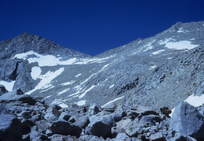
After the excitement of Conrad’s baptism, we did get a good start and churned up Forester Pass with surprising speed. We met a large pack train coming down this side of the pass with the brand of a triangle inside a circle, which we learned was three corner round. They had spent two or three days cutting the path in the snow fields for their mules to get down. It sure is easier to be on two legs once in a while. On the pass we had lunch and Ken found a pure white Polomonium, the purest white I’ve ever see this high altitude plant, which is usually blue. Below: looking up at Forester Pass, located in the notch.

Above: from the top of Forester Pass, looking south.

Above: Columbine found on the top of Forester Pass.
From the top of Forester, we straggled out and headed for the night’s destination: the first water and wood on the other side, the Wright lakes. As a group we hiked very slowly this afternoon, although Ken and Mike and I did some bombing as we left 30 minutes behind everyone from the pass and passed everyone before Wright lakes. We were all fairly tired at these lakes, and lazed around a few hours before supper. The fishermen scouted the area and saw a few fish in holes to be tried the next day, which was a layover. Below: in the area of Wright Lakes.

Today’s layover was to be a good chance for everyone to get away from everyone else. Mike left early.
Mike and I planned to meet at one of the high Wright Lakes, but when Ken and I got there he wasn’t to be seen. I sunned while Ken fished, and after an hour or so we heard a shout, very far away. It was Mike, but he was very high up on a wall to the south of the lake.
Ken stayed and I went up to meet Mike. He had found a section of rocks which was pulling away from the main wall in a 20 foot slice, just like a piece of cheese being cut off a block. Where it was coming off a trough was formed, ten feet deep vertical walls that looked like Mayan masonry. We were joined at the stoneworks by Kevin, who had been hiking by himself in the area. This young fellow is very mature for his age, and will be a fine mountaineer if he keeps it up.

We all speculated about the mysterious stone walled trench, then headed together toward Bernard Pk. This was a class 1 walkup, but the view was fantastic. In the registers, which dated back to the 1920s, we found lots of Norman Clyde signatures, 3 or 4. There was no wind, and the view of Whitney was very good. To the north east stood the mighty Mt. Williamson, a very imposing peak from any angle. To the west the Kaweahs shimmered in the distance across the Kern Trench. We had lunch and ran out of our short supply of water, then headed down through much scree and a field of nice polomoniums. Below: Whitney and Wales Lk from Bernard.


Above: me and Kevin on top of Bernard Pk. Whitney in the background. It was nice to get the boots off.
Back at camp we found that the fishing had been fantastic, and Kevin hurried to go get some fish at a higher lake. Ken had caught lots of fish, thrown most of them back and apparently all the cook groups had enough to add to their meals. We had a campfire around a fire built by John. White man build large fire, stand far back, Indian build small fire, stand close.
The topic of the evening was what our plans for the next few days would be. The itinerary decided by the group at Flower lake would have us move the next day to the Wallace lakes for a layover there, then to the top of Whitney Friday night, and down to the cars on Sat. Some people thought that the trip from Wallace to Whitney was too hard. This group wanted another layover here at Wright lakes, Thursday to Hitchcock lake, Fri over trail crest to the portal.
Some of us didn’t care for this plan because it would mean a layover in the same place for two days, plus missing the beautiful scenery, climbing, and fishing of the Wallace lakes, where we had been before a few years earlier on a 9-day trip. Its advantage was that it evened out the mileage. The final split was mostly old time hikers opposed to newer hikers, and the perfect solution was the splitting into two groups. To go to Wallace lakes were Ken, Mike, me, Chris Hughes, and Conrad. We were to meet the others at the top of Whitney and spend the night there, then hike down to the Whitney Portal together.
Day 26: After a fast breakfast the Mob split into two groups. We (me, Mike, Conrad, Chris and Ken) got one cookset together, and the five of us took off for Wallace Lakes. Conrad and Chris were sorry that the other two fishermen, Steve and Kevin, would not enjoy the incredible fishing we hoped to find. We cross countried most of the way, and found the camp that we had used several years earlier when with Wally Henry and Jim Lawrence. There we dropped packs and took lunch to the upper Wallace lakes. There we fished, sat, and sunned. The fish were spawning and the outlet was a black mass of fish that churned the water white when they were startled. I caught one by hand by swimming in the stream and grabbing a trout slowly by the gills in a rocky pocket. That evening we had very large trout, as many as the five of us could eat. Mike headed over toward Wales lake, where he took pictures and hiked till evening. The area was much drier than when we had been here last, but the view of the Kaweahs was fantastic.

Day 27: The plan for today was for Mike and I to climb by priorities: Russell, Constitution, Carillon, and Possibly Tunnabora. Ken and Chris wanted to climb Bernard, and bake cakes in the afternoon, and Conrad wanted to fish and bake. Mike and I left and hiked up the granite trough below Wales lake where two years earlier we had left Wendy and Byron when we climbed Constitution.
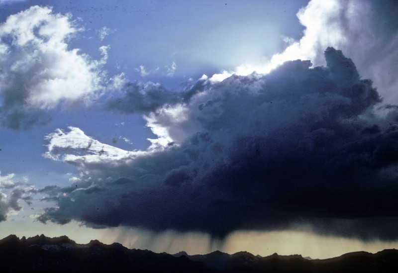
Wales lake looked the same as always, spectacular. At Tulainyo Lake the clouds were dark above us and a cold wind whipped us. To climb Russell we went up a 3rd class rock wall south of the lake, then hung a sharp right and started on some exposed 2nd and 3rd class to the first summit. This we signed in at the register, and continued to the true summit as the clouds swirled in on us, then were swept away by wind. The main mass of clouds was over Mt. Whitney, and I was watching for lightning there. Usually all the clouds that reached the summit of Russell were wisps and fragments of the big clouds massed over Mt. Whitney. We took the register to an overhang and read it over lunch, interrupted by runs out to look at rainbows and rain on the Kaweahs and Owens Valley and stuff like that. We got a small amount of rain and small hail. Below: Tulainyo Lake, mostly frozen over, Owens Valley behind, from partway up Mt. Russell.


Above: me in my Skeltor phase, or after losing a pound a day for 25 days. Drying my socks off near the top of Mt. Russell.

Above: Mike on top of Mt. Russell, signing in the register on top of the peak. He's wearing the new boots given to him by Kelty. these were prototypes, and had soft soles rather than Vibram soles. The brand was Vasque, and I think these were the first boots that Vasque made.
The register was a good one, rich in old time climbers and mountain history. In 1943, the register said, a man signed in, followed by the signature of a ranger looking for the same man, who went missing. The ranger assumed he had headed down the north face and would look there for him. The next entry was a further explanation. The Ranger had found the man’s body at the bottom of the north face, which he had tried to descend and had apparently fallen to his death. We had passed the place where he fell, and would pass it again on the way out. That was kind of creepy.
When the clouds cleared for a minute we packed up and left, moving as fast as possible while remaining safely on the rock and the route. Before going to Tulainyo Lake we climbed nearby Carillon, signed in fast, and continued to Constitution Pk., a peak hard to reach and seldom climbed.
There we found that one Raul DeSoto had climbed the peak since our ascent in 1969, and left a piece of paper. We left a notebook and pencil in a band-aid tin and entered our ascent of 1969 as the first recorded ascent, entering DeSoto after us, then adding an explanation of the placing of the register. We covered the register with a few rocks on the highest point, which is where other climbers would look first for it.
We descended down Constitution, crossed to Tunnabora, and drew in the awesome view of the entire Owens Valley below us. Near exhaustion we started back to camp, which we reached before dark. There we were surprised by the fantastic breads Ken had baked, one with chocolate topping that he had made out of the chocolate bars from our lunches. We had one bread for supper as the sun turned the Kaweah Peaks orange, and after supper made another bread, the best of all, that we planned to carry with two others to the top of Mt. Whitney the next day. After the bread baking we went to bed, planning to get up early for the long day to the top of Mount Whitney.

Day 28: It had rained a little bit during the night and when we got up shortly after first light the clouds were resting on the peaks of the crest and the Kaweah ridge. During breakfast a rainbow formed that arced across the entire valley we were camped in, and the day promised a cool hike as we started the two miles of cross country down to the John Muir Trail. There we talked with passing Sierra Clubbers and continued in intermittent sunshine toward Crabtree.

We had rain before we reached Crabtree meadows, and at the last wood below the pass we sat down and cooked dinner, planning to eat trail lunches and our breads for supper on the top of Mt. Whitney.
After dinner we gathered wood and filled our packs to overflowing with all the wood we could carry, planning to use it to cook with on top of Whitney. With packs heavier than anything we started up the pass, stopping at a stream to fill every container we had with water. We trudged in a cold breeze for a long time, and after seemingly endless switchbacks reached Trail Crest, the top of the pass. From there it was 1.9 miles of trail, and 1000' of elevation gain to the peak.
As we reached Trail Crest we met Steve, John and Nancy going down the other side of the portals. They and the rest of the group had decided not to spend a night on the peak in bad weather, probably a sane decision, but we five decided to watch sunset from Mt. Whitney. We were well enough equipped to survive any weather, although rain or snow would certainly be uncomfortable. The five of us had been looking forward to sleeping on the top too much to give up the plan.
As we regrouped at Trail Crest the cloud cover showed signs of breaking up, and the sun finally fought its way through to us. The warmth was really a blessing as we hauled on packs and continued carrying these water and wood filled packs at 14,000+ feet, toward the top of Mt. Whitney about a mile away and 300 feet higher than us. Below Muir Peak Chris, Ken and Mike dropped packs and went to climb the “little “ 14,000 bump.

Conrad was becoming sick from the exertion and elevation, almost to the point of throwing up, so I stayed with him, thinking I’d have time to climb Muir on the way out in the morning. Conrad and I continued slowly on the sky trail toward Whitney, battered between the pinnacles and notches with very strong winds. At one notch we found thousands of small squares of colored paper with an inscription in Tibetan (?) and mysterious figures dancing across the page. As we puzzled over them the turtle back of Whitney was bathed in a gold light, and we stumbled on, halfway expecting a holy revelation at the summit. As Conrad and I did the last switchback onto the summit the three tigers came steaming up behind us. Conrad stopped to rest and I went on with Ken to the register at the cabin. We signed in and went off to look for a campsite as clouds raged around the peak whipped by super winds. On the top of Whitney it was a flat area with a stone hut. The surrounding area was flat, with large rocks raised only a few feet above a bed of smaller rocks, so we just got away from a larger group that was camping near the cabin, and hoped that it wouldn’t rain or snow.
Ken lost a contact lens just before the sun went down, so we all froze our butts trying to find it. When we did (it was in his cuff) the sun had turned the west a beautiful orange, with clouds lined in gold that made us forget the cold wind and cold night ahead.

I found a far out place to sleep. It was a rock slab that had a space under it just big enough for all of me but one leg. I put my tube tent around me and my bag, and wormed my way in, leaving my head out till it started raining later that night. When I was fully inside it was very tight, and as it rained water ran down from the top of the rock and slowly, over a period of hours, soaked my down sleeping bag. I couldn’t see the world outside and slept in spurts till dawn.
I dreamed that Beth had come to see me, and was too cold to sleep. She came over to my bag to get in with me and be warm. She shook my shoulder to wake me….
“Bob, Bob” said Chris Hughes, shaking my shoulder.
“What?” I said, unzipping my bag to let Beth in.
“Bob, there’s snow all over and its falling fast,” said Chris.
“Damn! Lets get out of here before the trail is covered!” What a disappointment! It was Chris instead of Beth.
As I worked my way out of the rock crack I saw a world of gray and white, with the sky engulfed in clouds and the ground muffled in 2 inches of snow. The wind was strong and cold. Everyone was getting up, and we hurriedly dumped the 400 pounds of wood out of our packs, poured out 65 gallons of water, and either stuffed our sleeping bags in stuff sacs, or just jammed then into our now empty packs. I saw Ken fooling with his fishing pole, trying to get it in his pack, then he just snapped it in half and jammed it in his pack. Within ten minutes we were off down the trail, ponchos flapping in the wind and everyone soaked. We had 18 miles to hike to reach the car.
The snowline was very high, above Trail Crest, and from there we were splattered by rain. On the switchbacks the water was inches deep and after a time we gave up trying to keep out feet dry, and just went splashing through the puddles.
The water on the trail finally did my boots in, and the sole of one boot came loose from the arch to the toe. I had to throw it out and drag it back to walk in it, and even so I often turned it under. We bombed down to Trail Camp, and stopped there for a rest and to eat one of our breads. I took my boots off and put on running shoes. The place was alive with a group of scouts, with tube tents all over the place and kids running around everyplace. We must have looked like something strange, ponchos over huge packs, bearded and brandishing ice axes. We continued down and finally the clouds cleared and the rain stopped in Bighorn meadows.
We were not in the mood to stop and take off our ponchos, and we just barreled down the trail looking very out of place, but feeling like it was the people coming up carrying Coleman lanterns and thermos jugs who were out of place. The day trippers were amazing in the assortment of trivia that they hauled up the trail, from lawn chairs to Coleman stoves and picnic baskets.
Gravity pulled us down and down, and we finally reached Whitney Portals and rejoined the rest of our group. They had spent the night nearby, been rained on, and had missed the spectacle of the Whitney sunset. They found it hard to believe that if we were to do it again, we would chose to spend the night on Whitney and hike out in the rain. The last day and night was the best of the trip, especially since I was with people who had shared many experiences and good times in the mountains before. We all felt very good about finishing the JMT.
I was also very glad that the endless hassle was over and swore never to do it again. The only way is with a small group of good friends, or solo. We piled in cars and headed to the store at Olancha, tanked up on food, and went out to Dirty Sox hot springs for a splash.

Above: the gang at Dirty Sox HS: my brother Mike, Wes, Conrad, Ken, me (Bob Shaver), Chris, John, Kevin, Nancy, Steve S. Steve L, Madylin.
We had hiked 227 miles, climbed 17 peaks, and backpacked for 28 days. Some clean clothes and a shower at home in Lancaster put a nice end to the trip.
Notes immediately after the trip for next time:
- fewer people, 6 at most, 4 would be fine. A one week shakedown trip might help before the longer one.
- More food. The quality of ours was OK, but there just wasn’t enough for the big guys or for when we were really burning lots of calories.
- the food drops were OK once we got them organized, but it would be nice to simplify them, perhaps buying at stores wherever we came out, perhaps mailing packaged drops to post offices.
- it would be nice to take five or six weeks instead of 4. More time should be spent in the Evolution area for sure, also the Palisades. The pace of the last week was good.
44 years later, 2016: My backpacking lately has been with my son's Boy Scout troop, and we do 5-7 backpacks each year. I am in touch via email with Conrad, John Laine, Kevin, my brother Mike of course, Jim Lawrence, and Chris Hughes. Ken Primmer died of Parkinson's. Conrad's brother Mark, one of our hiking buds from the 70s, still actively backpacks. Kevin Anderson, his daughter Jenna and wife Suzanne have joined me and my son Jim, wife Tuckie, and daughter Laura and Ciera forbackpacks in the Sawtooths, Wind Rivers, Sierra Nevada, Uintas and White Clouds of Idaho of 5 to 7 days each. Kevin, now a federal judge, has joined my son and I on about 5 week long trip. In 2016 my son, then 2o years old and I hiked the JMT. My email address is shaverlaw@gmail.com