John Muir Trail, 2017
I put in for a permit for hiking the John Muir Trail in February 2017, with a start date of July 17. I had hiked the JMT in 2016 with my son Jim, and that was great. Things got real complicated when I had a stroke in February. I was down with vertigo for a week, and threw up constantly. I didn't eat for about a week. I was in the ER and ICU for three days, and was discharged when I started walking laps around the ICU floor. I think I was the only poor bastard who got out of there alive.
I set about walking as rehabilitation, and the dream of doing the hike inspired me to walk regularly, in which my wife Tuckie often joined me.. I walked with my backpack on, and over three months worked up to a 35 pound pack, walking 6 miles a day, and hiking up Table Rock, our local training hill, every day. The lingering effect of the stroke was lack of balance, and I hiked with poles to compensate. Initially I had to really focus on the ground 3 feet in front of me in order to not stagger around, and gradually I got better at walking a straight line and looking further ahead on the trail. I got a stress test, and the doc said my heart could do the hike. I felt pretty good when we left for the trip, me, my old bud Gary Fujino, his son Tomio, and Ian Willnerd, a veteran of the 2016 JMT hike.
I decided to keep my pulse rate below 140, since from training and the stress test I knew I could do 140 easily, and I could hike at a heart rate of 120 for several hours. I was a bit worried that my stroke was blood pressure related, since both vertibral arteries dissected at the same time. Below, Cottonwood lakes, our first nights destination. It was only 6 miles in, but at 10,000' elevation. I was not as exhausted this year as I was last year, but it was nice to get to camp and sit in the chair.

The second day Ian spotted a group of about 5 desert big horn sheep in the cliffs above camp. They were angling down to water I assume, and we saw them on and off for 15 minutes. The Mountain Heather below was near camp.

Next we went up and over new Army pass, at 12,300', and I was pretty darn slow. I had a wrist watch on that told me my heart rate, but there was quite a lag time. I could tell when my heart rate was above 130, and I'd stop and rest a bit till it came down. Up the pass it was stop and start, and I was slow, but we got there.
The last 20' to the top of the pass was snow covered, pretty steep, and Gary threw a rope down and dragged my pack 20' up the snow. I scrambled up a snow crack against a big rock, and got to the top of the pass feeling pretty good.

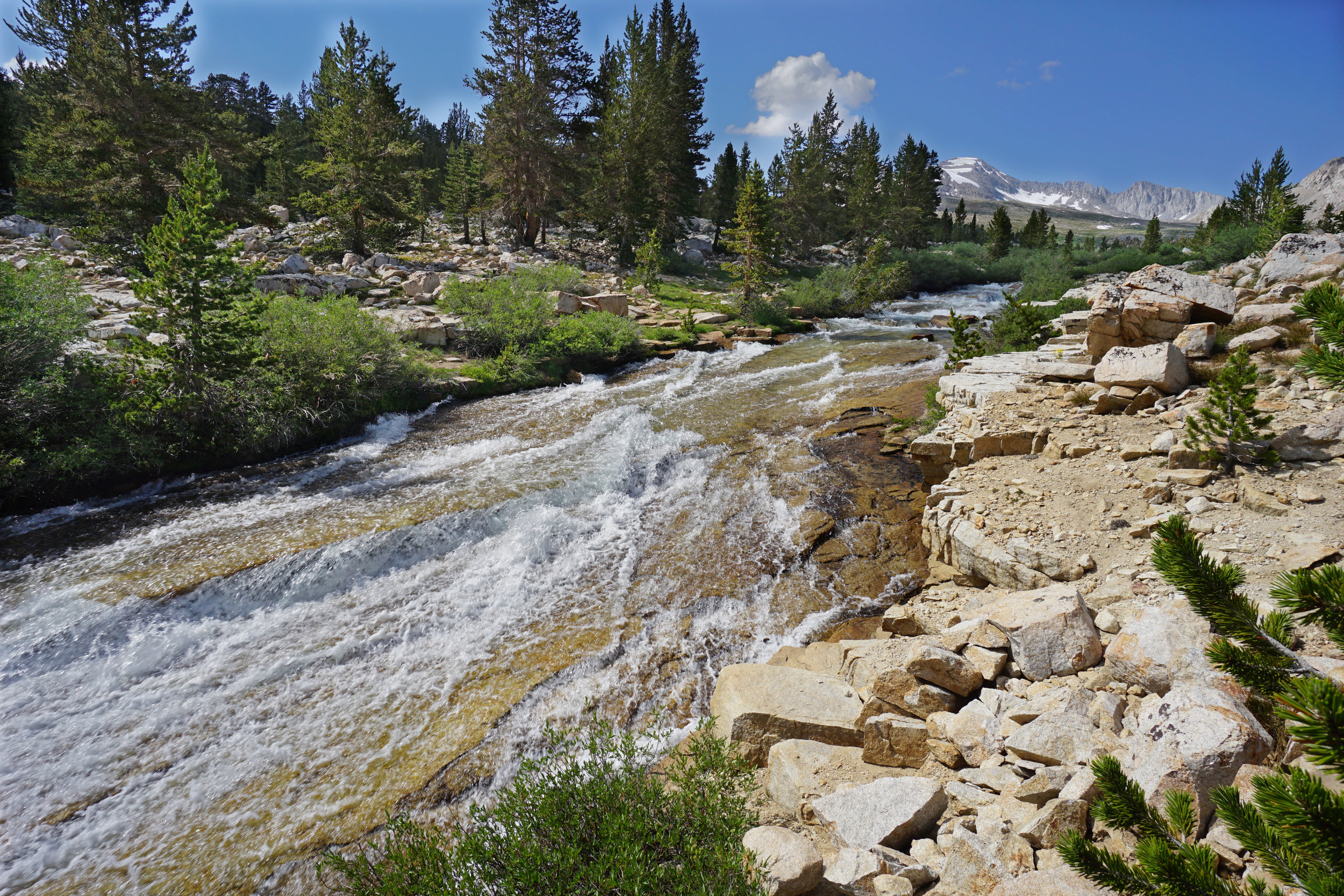
The next day we headed up Guyot Pass, which is about 800' in elevation gain, and forded Guyot Creek shown below. Last year when we got water out of this creek we had to use a cup to find enough water to put in our filter. This was easy enough to ford, but fortold a lot of stream crossings of streams that didn't exist the previous year.

On the third day Gary, Tomio, and Ian got up early and climbed Mt. Whitney from Lower Crabtree Meadow. I stayed in camp, and took a few pictures and videos. The next day we headed to the Tyndall Creek area for our next camp. When we got to Tyndall Creek we saw the scene below, and started searching around for a crossing site. The stream was super swift and footing looked slippery. This looked pretty scary and the runout was not encouraging. The video below shows me crossing at the place we deemed the safest to cross. When I got across the creek, my feet hurt like crazy from the icy water.
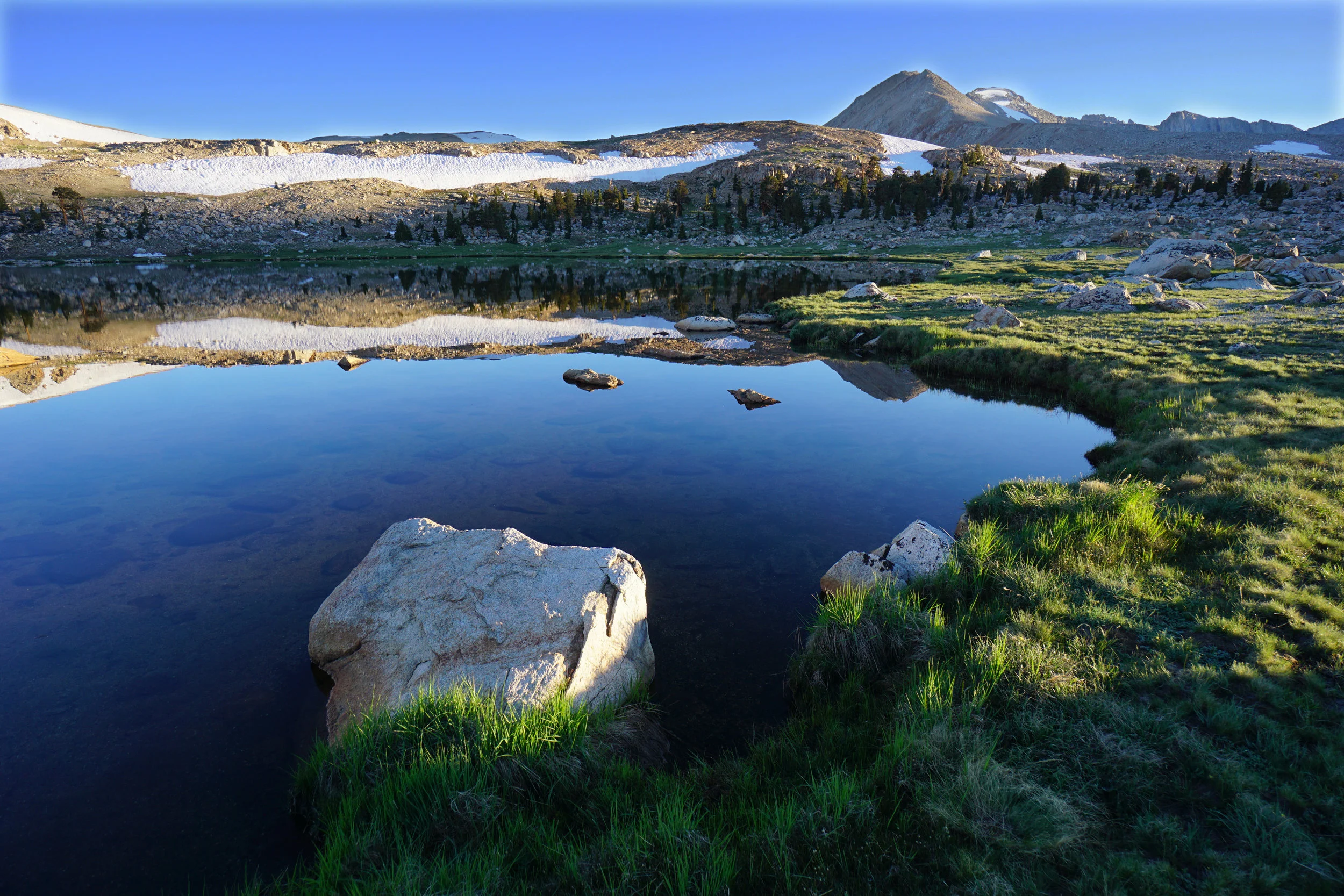
We got to a nice lake 200' above Tyndall Creek, and rested for the big push to Forester Pass the next day.
The south side of Forester had some snow cover, and we scrambled up large boulders to reach clear trail. The upper part of the trail was snow free thank God!

The north side of Forester Pass was snow covered for the top 600' at least, and going down Tomio sprained his ankle. This would cause him and his Dad Gary to have to hike out at Kearsarge Pass. Bummer!
We got to Vidette Meadow from Forester Pass, and enjoyed the view of the creek and food for the night. The next morning Gary and Ian headed up to the meeting place to intercept our food on the mule string. We got our food, but Gary and Tomio decided to head out at Kearsarge. Ian and I decided to keep going. We spent the night below Glen Pass, then headed up Glen Pass the next day. Both Ian and I went up the pass without using micro spikes, and on the top I put on the micro spikes plus I had hiking poles, and Ian didn't have either and didn't have any problems. Below: south side of Glen Pass.

We got to Rae lakes in the evening on a blustery day, cloudy with rain threatening. The trail went between the highest Rae lake, and the next Rae lake. The crossing was WAIST deep, and looked like suicide. We decided to take our chances by going cross country around the 2nd lake, and hoping we could get across the crossing between the 2nd and 3rd lake. We got about halfway around the lake, set up camp and it rained. The lake and the Painted Lady were nice when the sun came out.

The next day we headed around the lake, made the crossing successfully, and continued. We spent about two hours crossing streams, one in which I tripped in crotch deep water, and took a swim with my camera around my neck. Bummed, we hiked to the same campsite we were at last year, below the trail to Sawmill Pass, and I was less exhausted than last year. We crossed one stream where the water was scary fast, and the run-out was absolutely fatal. If you fell, you'd be flushed down 2000' of granite sluice way and you'd be beaten to death.
We decided to hike out Sawmill Pass to the Owens Valley, having heard of fatalities on some of the stream crossings ahead of us. I didn't think the mosquitoes were too bad until I saw the photo below:
